Featured Projects
U.S. Department of Energy, Washington Closure Hanford
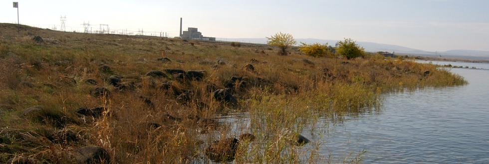
River Corridor Baseline Ecological Risk Assessment (RCBRA)
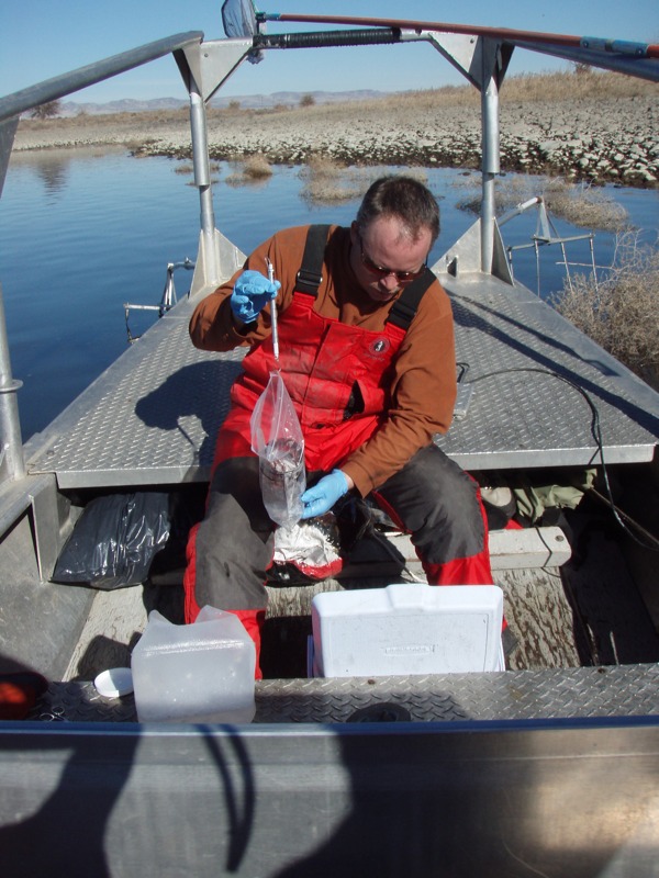
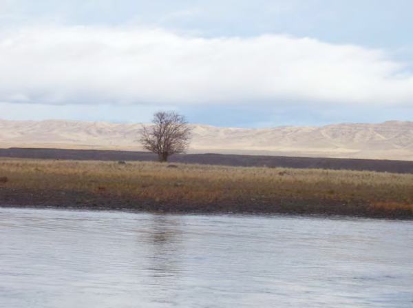
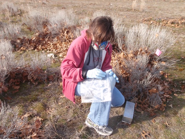
Sampling sculpin to assess contaminants in the Columbia River
Upland, riparian, and near-shore aquatic environments and species in the Hanford River Corridor, including the Hanford Reach National Monument, may be at risk from exposure to residual hazardous substance releases to the Columbia River.
To assess the nature and distribution of Hanford Site-related contaminants in the river, DOE conducted a baseline ecological risk assessment of the River Corridor. EAS scientists worked closely with DOE, the Environmental Protection Agency (EPA), and Washington Department of Ecology representatives to identify exposure pathways and which sites and species to evaluate (see diagram below). We used multiple lines of evidence to comprehensively assess the potential risk for adverse effects on plants and animals.
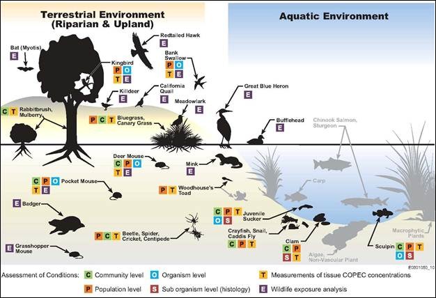
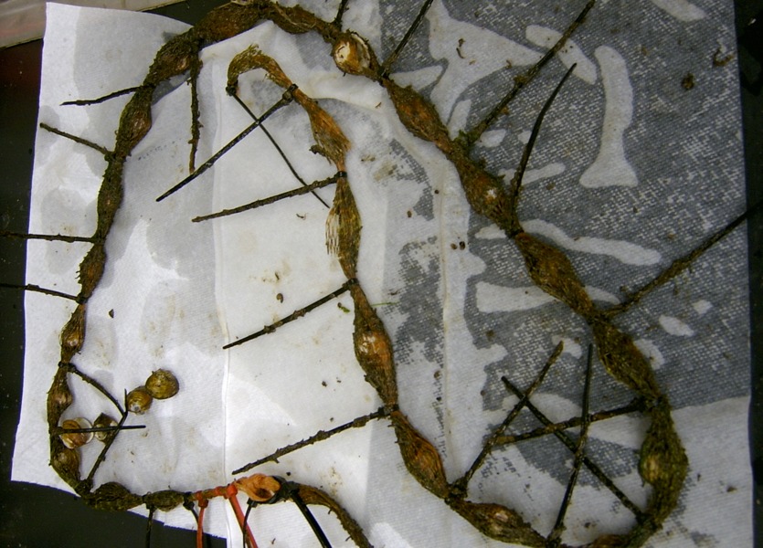
Identifying exposure pathways and identifying species to assess using an Eco guild diagram
From 2006 to 2009, EAS performed comprehensive field surveys and sample collection, processing, and shipping to help DOE assess risks to terrestrial and near-shore environments and species in the River Corridor. EAS prepared the sampling instructions, health and safety plans, quality assurance plans, and collected hundreds of samples of surface water, pore water, soil, vegetation, terrestrial invertebrates, small mammals, birds, aquatic macroinvertebrates, and fish throughout an approximately 50-mile stretch of the Columbia River. EAS processed samples requiring homogenization, dissection, or compositing at our laboratory and shipped them to analytical laboratories. EAS also performed the work to assess habitat suitability for threatened and endangered species; assess sample specimen conditions, colonization rates, and survival; and interpret field measures and contaminant results.
EAS successfully performed more than 10,000 labor hours and 200 boating days without a single incident or injury on this fixed-unit price contract. EAS also managed five subcontractors with no budget or schedule issues.
The Department of Energy publically released the two-volume ecological risk assessment report in 2012:
- River Corridor Baseline Risk Assessment Volume I: Ecological Risk Assessment, DOE-RL, DOE/RL-2007-21, Volume 1, Part 1, Rev 0.
- River Corridor Baseline Risk Assessment Volume I: Ecological Risk Assessment, DOE-RL, DOE/RL-2007-21, Volume 1, Part 2, Rev 0.
The reports can be found at: https://www.washingtonclosure.com/documents/mission_complete/RiskAsses/RCBRA_Vol_I_Rev_0_Part_1.pdf and https://www.washingtonclosure.com/documents/mission_complete/RiskAsses/RCBRA_Vol_I_Rev_0_Part_2.pdf
U.S. Department of Energy, Washington Closure Hanford
Performing Inter-Areas Sampling and Analysis

Investigating Asiatic clam survival in the near-shore aquatic zone
After sampling and analysis activities were completed as part of the River Corridor Baseline Risk Assessment (RCBRA), DOE identified the need for additional data from non-operational areas of the site between the Hanford 100 and 300 Areas, designated as the Inter-Areas Component.
To supplement data gaps, the EAS team sampled riparian and near-shore aquatic zones of the inter-areas. Surveys performed at 11 riparian investigation areas included soil texture evaluations, rare plant surveys, vegetation cover plot surveys, small mammal community surveys and sampling, and avian nesting performance evaluations. Between October 2006 and December 2007 the team conducted field sampling and surveys at 20 primary investigation areas in the near-shore aquatic zone. We sampled pore water, surface water, sediment, aquatic invertebrates, clams, mussels, juvenile toads, and fish. In addition, we performed surveys of threatened and endangered snails and salmonids, clam histopathology and survival, fish histopathology, and invertebrate community structure.
Results from this supplemental data collection effort were combined with previously collected data and used to complete a baseline risk assessment of the River Corridor. Federal regulators used the results of the assessment to support risk management decision-making for final records of decision.
The report can be found at: https://www.washingtonclosure.com/documents/mission_complete/wch274.pdf
U.S. Department of Energy, Washington Closure Hanford
Columbia River Component Risk Assessment: Screening-Level Ecological Risk Assessment
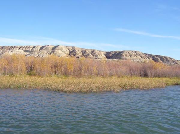
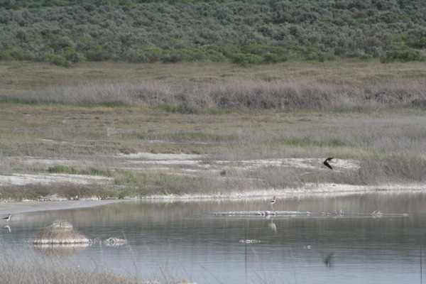
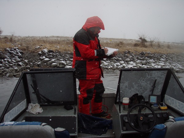
Surveying islands to understand habitats and island use
The River Corridor Baseline Risk Assessment (RCBRA) evaluated upland, riparian, and near-shore portions of the Hanford Reach. To provide a seamless assessment of the Columbia River, DOE also conducted a screening-level ecological risk assessment to assess surface water, sediment, island soils, pore water, and fish adjacent to and downriver of the Hanford Site. The assessment was conducted to obtain information about the potential for Hanford Site-related contaminants to affect the fish and wildlife species of the Columbia River.
The EAS team evaluated the main channel islands and areas of Hanford Reach and Lake Wallula, areas the RCBRA did not evaluate. As part of the assessment we conducted a habitat survey to identify general types of terrestrial and shoreline habitats present on islands and left-shore riparian zones as well as around sampling points used in the RCRBA. The purpose of this survey was to obtain an island-by-island understanding of habitats and island use to aid in interpreting sample results.
Documenting shoreline vegetation and topography
The EAS team conducted the survey by slowly circling each island by boat, observing, describing, and photo-documenting shoreline vegetation and topography. Upland vegetation and presence of wildlife or birds were recorded. We also noted common feeding, congregation, and nesting/breeding areas for avifauna and amphibians along the Hanford Reach. Results of the survey assisted DOE in understanding island and shoreline use, which is fundamental in assessing potential ecological risks.
In 2012, the U.S. Department of Energy publically released the Screening-Level Ecological Risk Assessment in two volumes:
- Columbia River Component Risk Assessment, Volume I: Screening-Level Ecological Risk Assessment, DOE/Rl-2010-117, Volume I, Part I, Rev. 0, June 2012
- Columbia River Component Risk Assessment, Volume I: Screening-Level Ecological Risk Assessment, DOE/Rl-2010-117, Volume I, Part 2, Rev. 0, June 2012
The reports can be found at: https://www.washingtonclosure.com/documents/mission_complete/ReleaseRA/2010-117_VI_R0_P1.pdf and https://www.washingtonclosure.com/documents/mission_complete/ReleaseRA/2010-117_VI_R0_P2.pdf
U.S. Department of Energy, Fluor Hanford
Central Plateau Terrestrial Ecological Risk Assessment
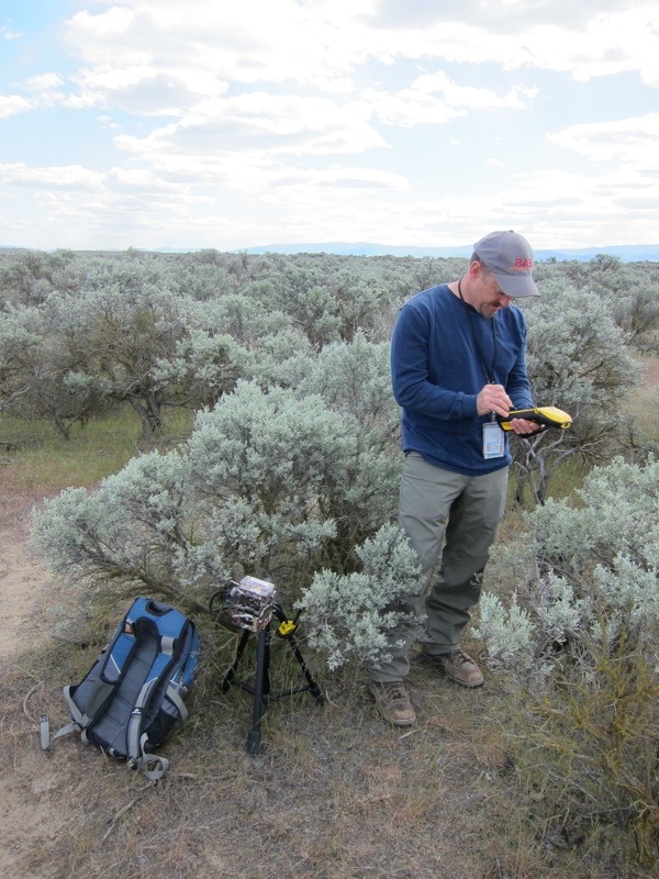
Characterizing shrub-steppe habitats to evaluate potential impacts from multiple contaminants
Beginning in 2005, DOE undertook an ecological risk assessment to evaluate potential impacts to terrestrial habitats from activities on Hanford’s Central Plateau, which covers 75 square miles of the Hanford Site. Monitoring studies showed that the Central Plateau contained multiple chemical and radionuclide contaminants associated with 700 waste sites. The purpose of this project was to conduct ecological characterizations to provide DOE with verifiable information on the health of the terrestrial environment on the Central Plateau that could be used to assess risk and make waste site remediation decisions.
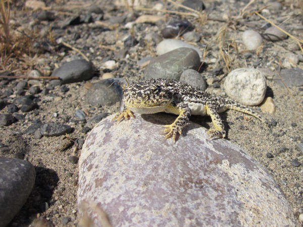
Measuring individual and population samples of lizards to assess risk
Population Characteristics. To support this large-scale assessment, EAS scientists assisted Fluor Hanford develop the data quality objectives and sampling and analysis plans, and we collected hundreds of field samples to evaluate the ecological health or condition of terrestrial habitats. EAS sampled air, soil, and biota and measured individual and population characteristics of lizards, mammals, and invertebrates. EAS also prepared the soil and biota samples at EAS’s sample processing facility. We used a multi-incremental sample compositing technique that helped reduce variability of the contaminant results so differences between sites was more readily detected. EAS also developed a tiered approach to assess risk to threatened and endangered species when collecting specimen samples was not practical.
Documenting species presence and habitat use at West Lake
Environmental Characterization – West Lake. At West Lake, EAS conducted a detailed environmental characterization to fill data gaps related to mammals, birds, amphibians, aquatic invertebrates, vegetation, and water quality. We also performed an exposure pathway verification and screening-level risk evaluation for West Lake. These activities included documenting current vegetative cover, species presence, and habitat use; collecting abiotic and biotic samples; and evaluating potential hazards of contaminants in sediment, surface water, pore water, mineral crusts, and aquatic macroinvertebrate tissue, as well as surface soil in and adjacent to West Lake.
Information from this study was important not only because it supported the risk assessment but also because it provided data on the ecological characteristics of West Lake. No such survey had been conducted there for more than 30 years.
Data Review. For this project, EAS also reviewed and analyzed findings from ecological risk assessment data collected between 2005 and 2007 and presented the findings to regulators and stakeholders. Our staff provided extensive review of the data quality following highest QA/QC standards set for government, industry, and CERCLA/RCRA investigations. We also incorporated ecological and contaminant data into a public-domain database and produced reports summarizing the data using the U.S. Environmental Protection Agency (EPA) ecological risk assessment guidance process.
In March 2008, the Department of Energy publically released Draft A of the Central Plateau Terrestrial Ecological Risk Assessment Report, DOE/RL-2007-50.
The report can be found at: http://pdw.hanford.gov/arpir/index.cfm/docDetail?accession=DA06834859
U.S. Department of Energy, Washington River Protection Solutions
Hanford Site Tank Farm Ecological Risk Assessment – WMAC
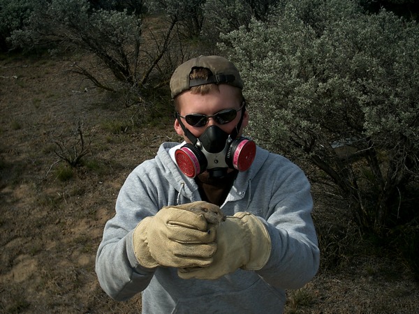
Sampling small mammals to ascertain contaminant risk
The Central Plateau of the Hanford Site houses 177 underground tanks grouped into 18 farms. The tanks store 56 million gallons of highly radioactive and chemical waste generated during World War II and Cold War weapons production. Characterizing environmental conditions and assessing ecological risk from the tank farms is a critical part of the site’s cleanup mission.
EAS prepared the field sampling instructions, health and safety plan, quality assurance plan, and led field sampling and prepared small mammal samples for analyses as part of an ecological risk assessment at the Waste Management Area C (WMAC) tank farm. The purpose of this investigation was to characterize small mammal communities surrounding the tank farm and ascertain risk to small mammals from contaminants of potential ecological concern (COPECs) originating from Hanford Site tank farm operations.
Assessing ecological risk to small mammals
We collected and processed samples of deer mice, western harvest mice, and Great Basin pocket mice. Information gathered from characterizing small mammal populations and analyzing tissue samples helped DOE substantiate current exposure models and aided in developing and implementing corrective measures to ensure long-term protection of the environment.
U.S. Department of Energy, Hanford Site Prime Contractors
Ecological Risk Assessment Data Quality Objectives, Sampling and Analysis Plans, and Sampling and Instruction Plans
Assessing ecological risk from past and present releases of contaminants
Developing data quality objectives (DQO) and sampling and analysis plans (SAP) are an important part of the ecological risk assessment process. For two years, EAS staff have assisted DOE and Bechtel Hanford, Inc. develop and prepare DQOs, SAPs, and sampling and instruction plans (SAI) to support the 100-BC Pilot Project and the River Corridor Baseline Risk Assessment. We also have presented relevant historical datasets and research to help regulatory agencies and stakeholders assess ecological risk from past and present releases of legacy materials attributable to Hanford operations.
The DOE and Hanford Site contractors have released a variety of reports related to the ecological risk assessment process, including the following:
- Central Plateau Terrestrial Ecological Risk Assessment Data Quality Objectives Summary Report, Phase II, WMP-25493, Fluor Hanford, February 2006.
This report can be found at: http://pdw.hanford.gov/arpir/pdf.cfm?accession=DA06717797
- Sampling and Analysis Instruction Guide for the 100 Area and 300 Area Component of the RCBRA Project, WCH-47 Rev. 0, July 2006.
This report can be found at: https://www.washingtonclosure.com/documents/mission_complete/100-300Area/WCH-47_SAI_Rev_0.pdf
- 100-B/C Area Ecological Risk Assessment Sampling and Analysis Plan, DOE/RL-2003-08, Rev. 0.
This report can be found at: https://www.washingtonclosure.com/documents/mission_complete/BC_SAP_Rev0.pdf
U.S. Department of Energy, Fluor Hanford
Using Artificial Burrows to Evaluate Inhalation Risks to Burrowing Mammals
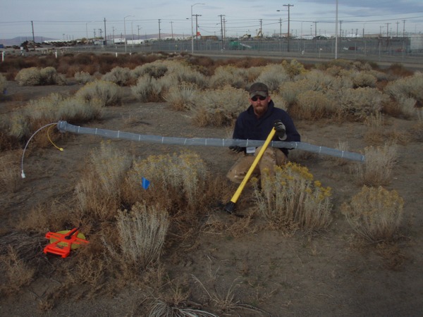
Constructing an artificial small mammal burrow system
Burrowing wildlife are key components of terrestrial ecosystems and serve as keystone species in arid environments. Through seed predation, seed caching, and burrowing, they greatly affect the abundance and distribution of biotic communities in the shrub-steppe ecosystem. On the Hanford Site, inhalation of volatile organic chemicals in the soil can be a significant exposure pathway for small burrowing mammals. As part of an ecological assessment project at Hanford, EAS constructed an artificial small mammal burrow system. We installed instruments in the system to measure concentrations of carbon tetrachloride in burrow air and evaluate inhalation exposure for wildlife, including Great Basin pocket mice and deer mice.
For more information on this project go to: http://onlinelibrary.wiley.com/doi/10.1897/IEAM_2008-013.1/abstract
U.S. Department of Energy, Pacific Northwest National Laboratory
Using Caged Clams to Assess Exposure and Effects of Contaminated Groundwater Upwelling
Evaluating the use of Asiatic clams to monitor contaminated groundwater upwelling
Researchers have detected concentrations of uranium, a contaminant of concern, in much of the shallow groundwater beneath the 300 Area of the Hanford Site near the Columbia River. Benthic organisms such as Asiatic clams are potentially at risk because they live in the unconsolidated riverbed where contaminated groundwater upwellings may occur.
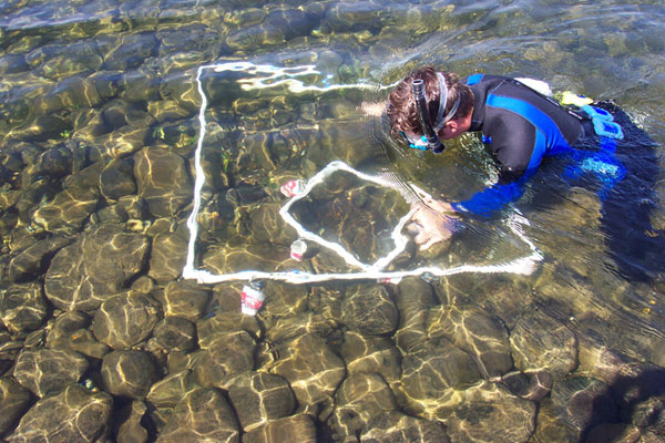
Performing snorkel surveys
EAS staff participated in a study to explore using caged Asiatic clams to monitor contaminated groundwater upwelling in the river’s near-shore environment and assess seasonal differences in uranium uptake in relation to seasonal river flows. We also examined the potential effects of uranium accumulation on growth, survival, and tissue condition of the clams.
In January 2008, Pacific Northwest National Laboratory publically released the following report describing this study:
- Evaluation of Using Caged Clams to Monitor Contaminated Groundwater Exposure in the Near-Shore Environment of the Hanford Site 300 Area , PNNL, PNNL-17270, January 2008.
The report can be found at: http://www.pnl.gov/main/publications/external/technical_reports/PNNL-17270.pdf