Featured Projects
U.S. Department of Energy, Mission Support Alliance
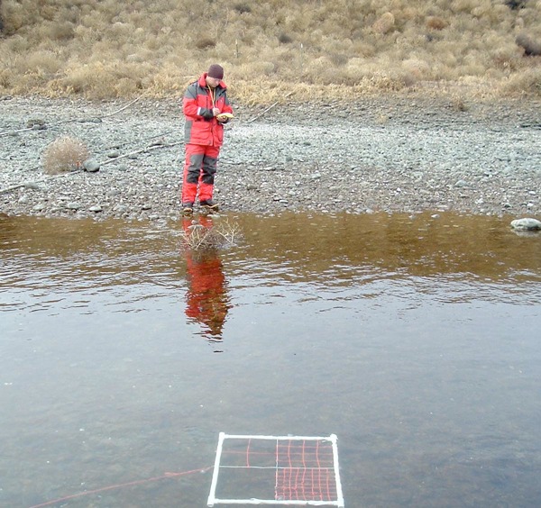
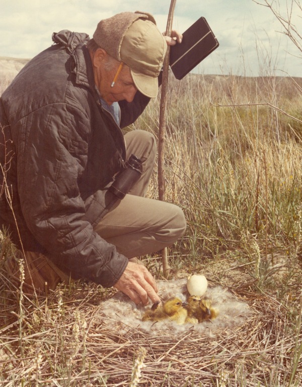
Public Safety & Resource Protection - Environmental Monitoring Project

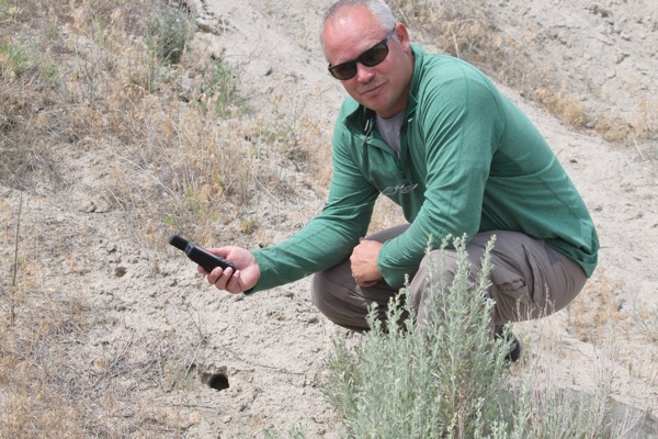
Evaluating populations and habitat quality of special status avian species such as ferruginous hawks
Photo credit: Larry Ridenhour
The Hanford Site provides a rich diversity of flora and fauna that have been protected from disturbance for 70 years. Because of this protection, native plant and animals thrive on the site that no longer exist in other parts of the region. An estimated 100 federal and state special-status species are known to occur on the site. The Environmental Monitoring Project, part of the Public Safety & Resource Protection program, is charged with fostering preservation of these important biological resources and minimizing impacts to them on the Hanford Site.
EAS staff members have supported the Environmental Monitoring Project for more than 30 years. Currently, we work with MSA to support to protect Hanford Site natural resources. Specific EAS responsibilities and support functions to the project are to:
- Characterize and monitor biota to assess their abundance, vigor or condition, and distribution
- Define and map habitats and species distribution for land-use planning
- Perform baseline surveys and monitoring to assess long-term trends in the condition of sensitive species and habitats
- Develop management and monitoring plans to help assess changes and trends in the condition of flora and fauna
- Assess impacts to biological resources from Hanford Site operations.
ESA staff work with MSA to conduct population-level surveys to monitor fish, wildlife, and plants. We monitor the following species and habitats:
- Federal and state endangered, threatened, sensitive, and candidate species. This includes 28 plant species, 3 mollusks, 3 insects, 6 fish species, 18 bird species, 3 species of amphibians and reptiles, and 5 mammal species
- Rare plants, including those classified by the Washington Natural Heritage Program as endangered, threatened, and sensitive species
- Fall Chinook salmon redds
- Steelhead redds
- Bald eagle nesting and communal night roosting sites
- Raptors, including ferruginous hawks
- Sagebrush-steppe dependent birds, including sage sparrows, sage thrashers, and loggerhead shrikes
- Burrowing owl nests
- Bat roosts
- Townsend ground squirrel colonies
- Mule deer
- Hanford elk
- Snake hibernacula.
Since 2012, the Department of Energy’s Public Safety & Resource Protection Program has publically released several ecological reports on wildlife monitoring for unlimited dissemination, including the following:
- Hanford Site Black-Tailed Jackrabbit Monitoring Report for Fiscal Year 2013, MSA, HNF- 56710 Revision 0.
- Black-Tailed Jackrabbit Monitoring Report for Fiscal Year 2012, MSA, HNF-54234 Revision 0.
- Hanford Site Ground Squirrel Monitoring Report for Calendar Year 2013, MSA, HNF-56374 Revision 0.
- Ground Squirrel Monitoring Report for Calendar Year 2012, MSA, HNF-53075 Revision 0.
The reports can be found at http://www.hanford.gov/page.cfm/EcologicalMonitoring
U.S. Department of Energy, Mission Support Alliance
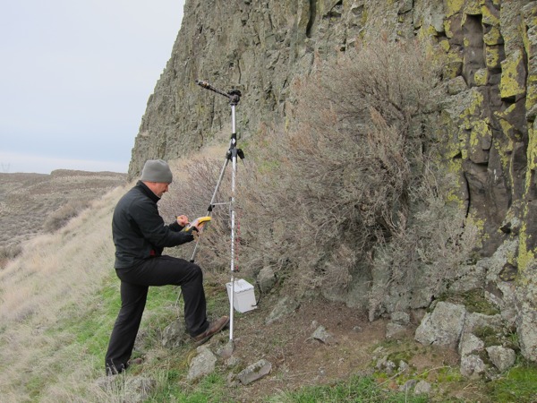
Locating and Protecting Bat Roosting Locations
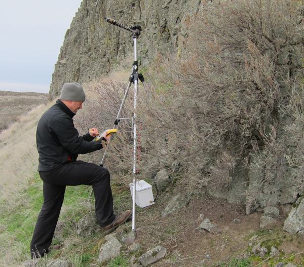
Winter Bat survey
Nine species of bats have been documented on the Hanford Site, and another eight species potentially could occur. Of these, the Washington Department of Fish and Wildlife lists three species—pallid bats, western small-footed myotis, and canyon bats—as State Monitor species. In addition, the WDFW considers roosting concentrations of big-brown bats, pallid bats, and all roosts for bats in the genus Myotis Priority Habitats. Roosting congregations can be maternity colonies, winter roosts, or night roosts. Bats are sensitive to disturbance, especially while pregnant, lactating, and hibernating. Unlike rodents, who give birth to multiple litters of several young each year, bats typically give birth once a year to only one pup, making bat populations extremely vulnerable to impacts and slow to recover. To avoid impacts to these sensitive species at Hanford, field surveys are conducted to identify and protect roost areas.
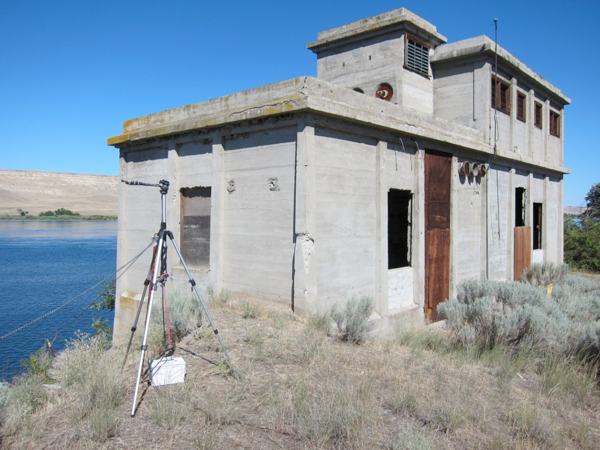
Surveying potential roost locations and bat activity centers
Monitoring studies have identified maternity colonies of Yuma myotis and pallid bats in abandoned buildings in the 100-F and 100-D Areas of the Hanford Site. And, since 2012, EAS has conducted surveys to identify bat activity in other areas of central Hanford. In summer 2012, we conducted acoustic monitoring over 119 nights at 17 locations and identified 35 sites as potential roost locations or bat activity centers. In summer 2013 we found several species using abandoned buildings as night roosts: pallid bats in the White Bluffs Bank and Cornelius Pumphouse; silver-haired bats in Bruggeman’s Warehouse, and little brown bats and pallid bats at the Hanford Town Site School. Also, we determined a maternity colony potentially exists in cliff faces on Gable Butte.
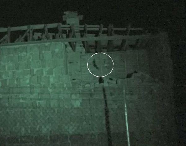
Pallid Bat Observed During 2013 Infrared Video Monitoring at White Bluffs Bank
In winter of Fiscal Year 2013, EAS identified and surveyed eight potential winter roosting habitats on the Hanford Site. We used acoustic monitoring to detect activity levels near these locations, mostly natural cliffs. Little brown bats were the only bat species recorded during winter monitoring surveys.
Since 2012, the Department of Energy’s Public Safety & Resource Protection Program has publically released three reports on bat monitoring for unlimited dissemination:
- Hanford Site Winter Bat Monitoring Report for Fiscal Year 2013, MSA, HNF-55280 Revision 0.
- Hanford Site Summer Bat Monitoring Report for Calendar Year 2013, MSA HNF-56359 Revision 0.
- Summer Bat Monitoring Report for Calendar Year 2012, MSA HNF-53759 Revision 0.
The reports can be found at http://www.hanford.gov/page.cfm/EcologicalMonitoring
U.S. Department of Energy, Mission Support Alliance
Mapping Known and Potential Snake Hibernacula Locations
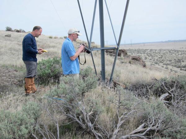
Field team members document the newly discovered hibernacula on Gable Butte
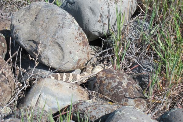
Snakes fill an important role in the ecosystems they occupy, including the shrub-steppe. They congregate at specific sites known as hibernacula, which provide essential habitat. A single hibernaculum may contain hundreds of snakes, often of several different species. Finding and protecting snake hibernacula is critical to maintaining Hanford Site populations of common and sensitive species. State sensitive species documented on the site include the striped whipsnake, a Candidate for listing as Threatened or Endangered as well as night snakes and racers, State Monitor species. These three sensitive species could be sharing hibernacula with other snakes known to be present on the Hanford Site, including gopher snakes, common garter snakes, western terrestrial garter snakes, and western rattlesnakes. Destruction of hibernacula can result in losses to local populations.
In 2012, EAS conducted some of the first surveys to map known and potential snake hibernacula locations on the Hanford Site. Field teams located six new hibernacula during the 2012 survey, increasing the number of known active hibernacula from three to nine. During the 2013 survey, project personnel discovered an additional 14 new dens bringing to 23 the number of known, active dens on the Hanford Site. This information can be used to monitor populations and distribution over time. It also assists DOE in protecting valuable resources while planning site activities.
Surveying and mapping known and potential snake hibernacula locations
Since 2012, the Department of Energy’s Public Safety & Resource Protection Program has publically released two reports on snake hibernacula monitoring for unlimited dissemination:
- Hanford Site Snake Hibernacula Monitoring Report for Calendar Year 2013, MSA, HNF-56087 Revision 0.
- Snake Hibernacula Monitoring Report for Calendar Year 2012, MSA, HNF-53026 Revision 0.
The reports can be found at http://www.hanford.gov/page.cfm/EcologicalMonitoring
U.S. Department of Energy, Mission Support Alliance
Surveying Rare Plants on the Hanford Site
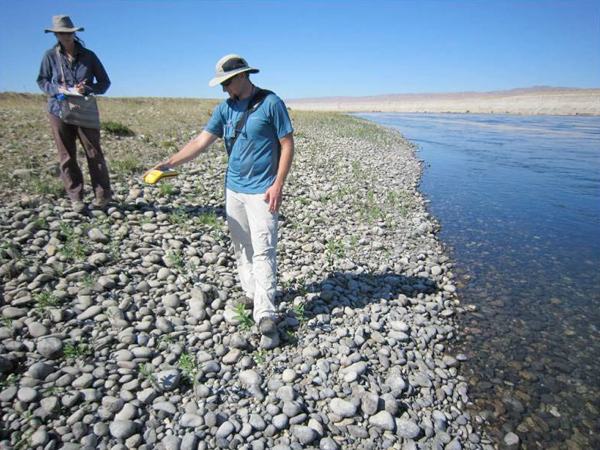
Surveying rare plants along the Hanford Reach
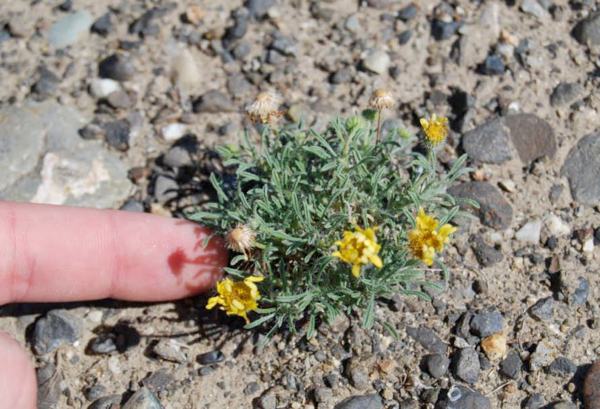
Several rare plant species are known to occur on the Hanford Site, including at least eight riparian species of concern along the shoreline of Hanford Reach of the Columbia River. The Public Safety and Resource Protection program places a high priority on monitoring plant and animal species or habitats with specific regulatory protections or requirements, are rare and/or declining, or are of significant interest to federal, state, or tribal governments or the public.
Since 2011, the EAS team has monitored rare plant populations on the site to gain information on the distribution and vigor of these populations, minimize potential Hanford Site-related impacts to these species, and assess changes in their status or distribution over time. The 2011 studies focused on surveying the south and west banks of the river shoreline for Columbia yellowcress and Piper’s daisy.
Piper’s daisy, endemic to the Columbia Basin, is considered state sensitive because of its limited range, habitat loss, and relative isolation of remaining populations. Our 2011 monitoring goals were to establish a current baseline for Piper’s daisy in the 200 Areas, and document the size and population structure of occurrences at previously known sites. Monitoring this species was particularly important because the area was undergoing cleanup activities that involved habitat disturbances.
Monitoring state sensitive species to determine distribution and vigor and assess changes over time
Over the 2011 and 2012 seasons, the EAS team surveyed a total length of 63 miles along the Columbia River to map the distribution of Columbia yellowcress and document patch sizes and ramet abundance. The open cobble shoreline of the Hanford Reach provides the largest known occurrence of this rare plant, a federal species of concern and state endangered species. Extensive damming of the river has eliminated its habitat along much of the remainder of the river shoreline. These surveys identified a total of 245 patches of Columbia yellowcress along the river shoreline. Field crews counted 91,000 individual ramets at these sites over two years.
Rare plant monitoring surveys in 2013 focused on population status assessments of a subset of the known populations of Columbia yellowcress and spot-surveys for other rare riparian species that could be affected by waste site remediation work along the river shoreline, environmental sampling activities, and maintenance of Hanford Site infrastructure. The field team identified four riparian species the Washington Natural Heritage Programs lists as threatened or sensitive. These species included lowland toothcup, Canadian St. John’s wort), awned half-chaff sedge, and chaffweed found to be relatively common at all five of the survey areas.
Since 2011, the Department of Energy’s Public Safety & Resource Protection program has publically released three reports on rare plant monitoring for unlimited dissemination:
- Hanford Site Rare Plant Monitoring Report for Calendar Year 2013, MSA, HNF-56799 Revision 0.
- Hanford Site Rare Plant Monitoring Report for Calendar Year 2012, MSA, HNF-54686 Revision 0.
- Rare Plant Monitoring Report for Calendar Year 2011, MSA, HNF-52260 Revision 1.
The reports can be found at http://www.hanford.gov/page.cfm/EcologicalMonitoring
U.S. Department of Energy, Mission Support Alliance
Counting Fall Chinook Salmon Redds and Identifying Redds Located in Areas of Potential Contaminated Groundwater Upwelling
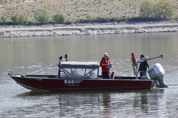
Conducting aerial surveys to identify and count salmon redds in the Hanford Reach
The Hanford Reach supports the largest run of spawning fall Chinook salmon remaining in the Pacific Northwest. Salmon play important roles in the regional ecology, culture, and economy. Preserving this population is vital in preserving and restoring other depleted Chinook stocks in the Columbia Basin. The Department of Energy began conducting aerial surveys to identify and count salmon redds in the Hanford Reach in 1948. Understanding the location of spawning is a critical part of managing long-term trends in Chinook salmon redd abundance and distribution. EAS staff members have participated in monitoring redd abundance and distribution in the Hanford Reach since the 1970s. Currently, we work with MSA to monitor relative abundance among spawning areas and years and document the onset of spawning, locate spawning areas, and determine intervals of peak spawning activity.
Since 2011, the EAS team has conducted aerial surveys of fall Chinook salmon redds in eleven areas of the Hanford Reach consistent with past survey efforts and the historical database. In 2011, the Department of Energy added eight new sections of the river to better monitor the abundance and distribution of fall Chinook redds in areas of potential upwelling of contaminated groundwater. During the four aerial surveys in 2011, the field team identified a total 8,915 salmon redds, 2,533 located in areas identified as potential sites of groundwater upwelling. A total of 8,368 redds were counted in 2012 surveys, 2,012 in areas directly adjacent to Hanford Site operations.

Digital camera mounted over airplane hatch - fall Chinook redd monitoring
In 2013, EAS conducted aerial surveys the entire length of the Hanford Reach, from Priest Rapids Dam downstream to the I-82 bridge. In conjunction with visual surveys the survey team took vertical aerial photographs to compare counts between visual estimates and photographs. The photographs were intended to capture 100% of the Reach so all visible redds could be counted using a Geographic Information System (GIS). In 2013, the peak annual visual redd count was 17,398, almost double the number counted in 2012 and exceeding the all-time high of 9,465. With the addition of aerial photographs, we estimated a total of 26,193 Chinook salmon redds in the Hanford Reach.
Using vertical aerial photographs to compare counts between visual estimates and photographs
To ensure compatibility and consistency with past survey efforts and the ongoing Hanford Reach Fall Chinook Protection Program, EAS thoroughly reviewed and adopted past monitoring protocols, coordinated/trained with former redd count personnel, and coordinated and exchanged information with the Washington Department of Fish and Wildlife and the Grant County Public Utility District. EAS also used maps detailing the entire survey reach as well as all historical sub-areas and spawning sites both as in-flight guidance documents and field data recording forms. We relied on the same air service, airplane, and pilots used in previous years.
Since 2011, the Department of Energy’s Public Safety & Resource Protection Program has publically released three reports on fall Chinook salmon redd monitoring for unlimited dissemination:
- Hanford Reach Fall Chinook Redd Monitoring Report for Calendar Year 2013, MSA, HNF- 56707 Revision 0.
- Hanford Reach Fall Chinook Redd Monitoring Report for Calendar Year 2012, MSA, HNF-54808 Revision 0.
- Fall Chinook Redd Monitoring Report for Calendar Year 2011, MSA, HNF-52190 Revision 0.
The reports can be found at http://www.hanford.gov/page.cfm/EcologicalMonitoring
U.S. Department of Energy, Washington Closure Hanford
Characterizing Aquatic Habitat for Steelhead Spawning
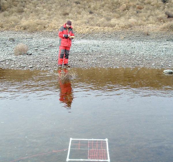
Characterizing aquatic habitat for steelhead spawning
Steelhead in the Hanford Reach of the Columbia River are part of the Upper Columbia River Evolutionally Significant Unit (ESU), which includes all naturally spawned steelhead in Columbia Basin streams from the Yakima River to the U.S.-Canadian border. Steelhead in this ESU are federally threatened under the Endangered Species Act. Historical studies estimate that as many as 10,000 steelhead may have spawned in the Hanford Reach from 1962 to 1971 and approximately 9,000 between 1977 and 1996. However, recent estimates of the number of steelhead that spawn in the Hanford Reach are sketchy and the amount and location of suitable spawning habitat in the area is poorly understood.
To help answer this question, in 2007, the EAS team conducted surveys in the 100 Area, 300 Area, and inter-areas of the Hanford Reach to determine if steelhead spawning habitat existed in these locations, according to accepted habitat suitability criteria, and document any steelhead spawning activity (fish or redds) at these sites. Characterization of the sites was important because steelhead spawning in these areas may be subject to man-induced risks, including chemical and/or radiological releases attributable to the Hanford Site and shoreline and riverbed modifications that cause siltation or affect habitat. Other activities that could present a risk to steelhead spawning include disturbance by biological and groundwater monitoring and treatment activities near the shoreline, ecological and cultural research and monitoring programs conducted on the river or shoreline, and alterations of the shoreline for public access purposes.
No adult steelhead or steelhead redds during February 2007; however, the field team found conditions entirely suitable for spawning at eight sites in survey locations along the Reach. Information from these surveys contributed to the process for assessing potential risk to ESU-listed steelhead from Hanford Site operations.
In 2008, Washington Closure Hanford publically released a summary report of steelhead spawning habitat as part of a risk assessment report:
- Inter-Areas Component of the River Corridor Baseline Risk Assessment Sampling Summary, Washington Closure Hanford, WCH-274, Rev. 0., Appendix E, Suitability of Aquatic Habitat for Steelhead Spawning at Selected Sites in the Hanford Reach of the Columbia River
The full report can be found at https://www.washingtonclosure.com/documents/mission_complete/wch274.pdf
U.S. Department of Energy, Mission Support Alliance
Assessing Steelhead Spawning Habitat in the Hanford Reach
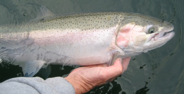
Monitoring long-term trends in steelhead redd abundance and distribution
Aerial counts of steelhead redds have been conducted annually in the Hanford Reach since 1998. From 1998-2011, Pacific Northwest National Laboratory performed the counts as part of the Public Safety and Resource Protection Program. In Spring 2012, EAS began conducting these surveys for the PSRP. The purpose of the surveys is to identify potential steelhead spawning areas and timing as well as provide an annual index of relative abundance among spawning areas. Although no steelhead redds were observed in 2012, our 2013 aerial and underwater observations support past evidence that limited steelhead spawning does occur in the Hanford Reach. During two aerial surveys, and a boat-based field survey to validate the aerial survey, EAS identified four steelhead redds in the Hanford Reach. No steelhead redds were observed in areas of potentially contaminated groundwater upwelling in 2013.
Because long-term trends in redd abundance and distribution are important monitoring components, EAS took several steps to ensure compatibility and consistency with past efforts. These included reviewing and adopting past monitoring protocols, coordinating/training with former redd count personnel, using maps detailing the entire survey reach as well as all historical sub-areas and spawning sites, both as in-flight guidance documents and as field data recording forms, and relying on the same air service, airplane, and pilots used in previous years.
Since 2012, the Department of Energy’s Public Safety and Resource Protection Program has publically released two reports on steelhead redd monitoring for unlimited dissemination:
- Hanford Site Steelhead Redd Monitoring Report for Calendar Year 2013, MSA, HNF-56705 Revision 0.
- Steelhead Redd Monitoring Report for Calendar Year 2012, MSA, HNF-53665 Revision 0.
The reports can be found at http://www.hanford.gov/page.cfm/EcologicalMonitoring
U.S. Department of Energy, Mission Support Alliance
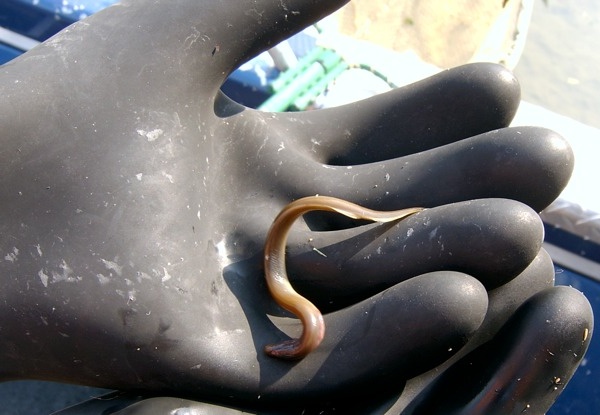
Characterizing Juvenile Pacific Lamprey Habitat
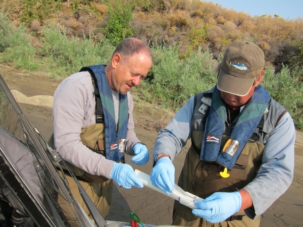
Determining available Pacific lamprey habitat in the Hanford Reach
Pacific lamprey are part of an ancient lineage of fish that is culturally and religiously important to Native American tribes in the Mid-Columbia River Plateau. The species has declined in the Pacific Northwest potentially as a result of impeded passage at dams, over harvesting, degraded habitat, and chemicals used to control non-native fish. Pacific lamprey are listed as a federal species of concern and state monitor species. Except for general life history patterns, little is known about the ecology of lampreys in the Columbia River Basin.
In 2012, EAS conducted the first assessment of larval Pacific lamprey ever to be conducted on the Hanford Reach. The purpose of this characterization was to better define the basic biology of larval Pacific lamprey to guide determinations of available habitat in the Reach. Understanding critical habitat requirements is key to determining if the basic needs of fish and other organisms are being met.
Assessing larval Pacific lamprey, a federal species of concern, to better understand its biology
EAS surveyed the 51-mile-long Reach for potentially suitable habitat using coarse scale metrics. Suitable habitat areas are characterized by fine-grained substrates, which are relatively rare on the Hanford Reach. We used existing substrate maps to define survey areas and logged the habitat transects with a Global Positioning System (GPS). Areas containing suitable habitat were distinguished as adjacent or not adjacent to known Hanford groundwater contamination plumes. Our research team then sampled suitable habitat zones with an ABP-2 backpack electrofisher designed specifically to collect juvenile lamprey. Of the nine locations surveyed, lamprey were detected at two sites, both in or immediately adjacent to known contaminated groundwater plumes.
According DOE’s Public Safety & Resource Protection program database, researchers have identified juvenile lampreys in the past using conventional electrofishing methods, but these detections were extremely infrequent (≤5 individuals during hundreds of electrofishing hours). Comparatively, this study encountered 53 individual lampreys in approximately four hours of electrofishing. Using the ABP-2 backpack electrofisher with the updated settings improved survey efficiency and detectability of larval Pacific lamprey along the Hanford Reach.
Sampling suitable lamprey habitat zones with an ABP-2 backpack electrofisher
EAS conducted all electrofishing in accordance with a National Marine Fisheries Service Scientific Research Permit (#14283) and a USFWS Endangered Species Act consultation (#13260-2011-1-0080).
In 2013, the Department of Energy’s Public Safety and Resource Protection Program publically released a report on steelhead redd monitoring for unlimited dissemination:
- Calendar Year 2012 Assessment of Larval Pacific Lamprey on the Hanford Reach of the Columbia River, MSA, HNF-55606
The report can be found at
http://www.hanford.gov/files.cfm/HNF-55606_-_Rev_00_NC.pdf
U.S. Department of Energy, Washington Closure Hanford
Characterizing Mollusks and Other Macro-Invertebrates
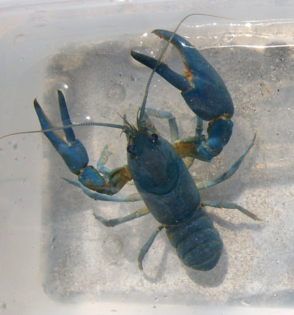
Gathering baseline information on crayfish to understand potential impacts to aquatic ecosystems
Fish, shellfish, and other macro-invertebrates are important components of healthy aquatic ecosystems. Many of these species are declining as a result of contaminated habitat. Understanding potential impacts to aquatic ecosystems from hazardous waste sites requires gathering initial baseline information on species and habitats that may be present in the environment.
To assist DOE meet a need for information on mollusks and other macro-invertebrates in the Hanford Reach, EAS surveyed more than 40 locations in the riparian and aquatic zones between the 100 and 300 Areas of the Hanford Site.

Assessing macroinvertebrates to evaluate species abundance and diversity
EAS located, identified, collected, and measured mollusks, including rare species such as the pebble snail and spring snail, and characterized their habitats. We also sampled crayfish, mayfly larvae, caddisfly larvae, and worms. The purpose of this project was to measure contaminant uptake and evaluate species diversity, abundance, and biomass. The information was used to support federal and state decisions on risk management.
In 2008, Washington Closure Hanford publically released two reports of mollusk observations for the 100/300 Area and inter-areas of the Hanford Site as part of a risk assessment report:
Inter-Areas Component of the River Corridor Baseline Risk Assessment Sampling Summary, Washington Closure Hanford, WCH-274, Rev. 0., Appendix F, Mollusk Observations for the 100/300 Area.
Inter-Areas Component of the River Corridor Baseline Risk Assessment Sampling Summary, Washington Closure Hanford, WCH-274, Rev. 0., Appendix G, Mollusk Observations Along the Hanford Reach of the Columbia River. Habitat Assessment and Likelihood of Species Present.
The full report can be found at https://www.washingtonclosure.com/documents/mission_complete/wch274.pdf
U.S. Department of Energy, Pacific Northwest National Laboratory
Assessing Species Composition, Densities, and Distribution of Native Freshwater Mussels
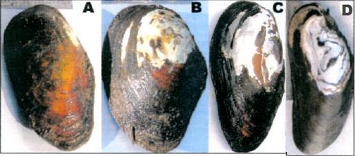
Mussel species observed along the Hanford Reach during 2004
Freshwater mussels are said to be one of the most imperiled groups of organisms on the planet. In the Pacific Northwest, the Hanford Reach, the last un-impounded section of the Columbia River, provides habitat suitable for many native mussels known to exist in the region. These include vulnerable species in the Anodonta genus such as the California floater, a federal species of concern and Washington State candidate for listing as threatened or endangered; Oregon floater, western floater, and winged floater, all state monitor species; as well as western pearlshell, considered extirpated in the Reach. However, information concerning native mussel species composition, densities, and distributions in the mainstem Columbia River is limited.
In 2004, EAS, working with Pacific Northwest National Laboratory, conducted snorkel surveys in the Hanford Reach to locate, identify, and measure freshwater mussel species inhabiting near-shore habitats. The study was intended to provide a more comprehensive characterization of freshwater mussel species composition and distribution in the Hanford Reach, estimate mussel densities, and determine the age structure of mussel populations.
The field team surveyed 52 transects (for a total 28,482 m2 of river bottom) at water depths of 1 to 2 m on the Benton County shoreline of the Reach. Transects were located where mussel beds were known or suspected to exist and areas near Hanford Site decommissioned reactor facilities. At each sampling point, mussel species composition and number of individuals observed were recorded. Mussel density was estimated based on near-shore habitat characteristics, including substrate size, substrate embeddedness, relative abundance of aquatic vegetation, and large-scale geomorphic/hydrologic characteristics of the Hanford Reach.
The field team observed and measured 201 live native mussel specimens. Three species belonging to the Anodonta genus were common in habitats dominated by sand/silt substrates. The western floater and Oregon floater were found in virtually all substrate types sampled in approximately 60% of the Hanford Reach. They were frequently encountered in locations where the riverbed was at least partially embedded. The California floater was found in areas primarily characterized by high substrate embeddedness and low river water velocities. The western pearlshell mussel was almost completely absent from the 2004 survey. However, several shells found in two transects indicate a few small populations of the western pearlshell mussel may still exist at water depths greater those surveyed.
Pacific Northwest National Laboratory publically released a report on the 2004 mussel studies in 2011:
- Assessment of the Species Composition, Densities, and Distribution of Native Freshwater Mussels along the Benton County Shoreline of the Hanford Reach, Columbia River, 2004, 2011, Pacific Northwest National Laboratory, PNNL-19933, Richland Washington.
The report can be found at:
http://www.pnnl.gov/main/publications/external/technical_reports/PNNL-19933.pdf
U.S. Department of Energy, Mission Support Alliance
Performing Freshwater Mussel Surveys in the Hanford Reach

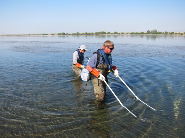
Performing SCUBA surveys to collect mussel species and document age, densities, composition, and distribution
In 2013, EAS staff conducted a second mussel survey to further characterize and provide a more complete understanding of populations of Anodonta in the Hanford Reach. Because mussels have long lifespans, remain relatively immobile, and are relatively sensitive to changing environmental conditions, they make ideal sentinel/indicator species for ecological impacts such as contamination.
The field team performed surveys using self-contained underwater breathing apparatus (SCUBA) to collect species and document age, densities, composition, and distribution. This method allowed us to extend transects into deeper water [down to 9 meters (30 feet)] than our 2004 survey efforts allowed. We mapped habitat characteristics from a boat using a Trimble global positioning system (GPS) and underwater video camera. For the 2013 surveys, EAS used a technical approach comparable to the 2004 study. Survey areas were selected adjacent to and away from known contaminated groundwater plumes.
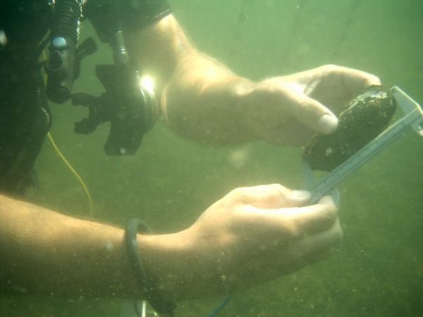
Collecting mussels and measuring shell lengths to determine possible demographical trends
Because of the similarities between surveys performed in 2004 and 2013, we compared several factors of the two datasets to determine if trends could be discerned in Anodonta populations along the Hanford Reach. In 2004, the field team collected 196 mussels collected with minimum and maximum mussel shell lengths of 47 mm (1.9 inches) and 143 mm (5.6 inches). The 75 mussels collected from the genus Anodonta in 2013 ranged in length from 60 mm up to 129 mm (2.4 to 5.1 inches).
The length distributions of Anodonta were used to compare size-classes as an indicator of possible demographical trends. Although questions remain, the comparison of datasets indicated the population of Anodonta present along the Hanford Site appears to be relatively stable.
In 2013, the Department of Energy’s Public Safety and Resource Protection Program publically released a report on freshwater mussel monitoring for unlimited dissemination:
- Hanford Site Freshwater Mussel Monitoring Report for Calendar Year 2013, MSA, HNF-56238 Revision 0.
The report can be found at http://www.hanford.gov/page.cfm/EcologicalMonitoring
Grant County Public Utility District
Assessing Potential Benthic Community Impacts from a Columbia River Drawdown
Characterizing benthic communities potentially affected by an unanticipated river drawdown
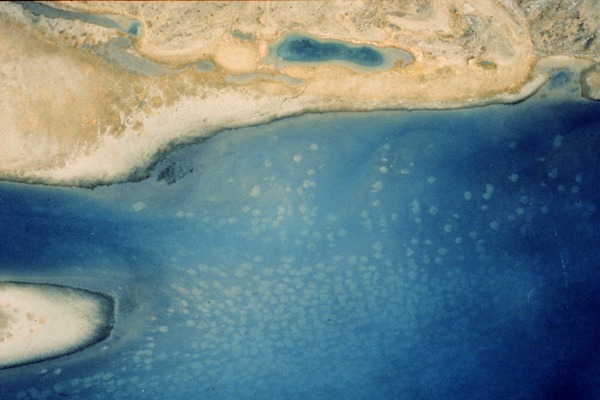
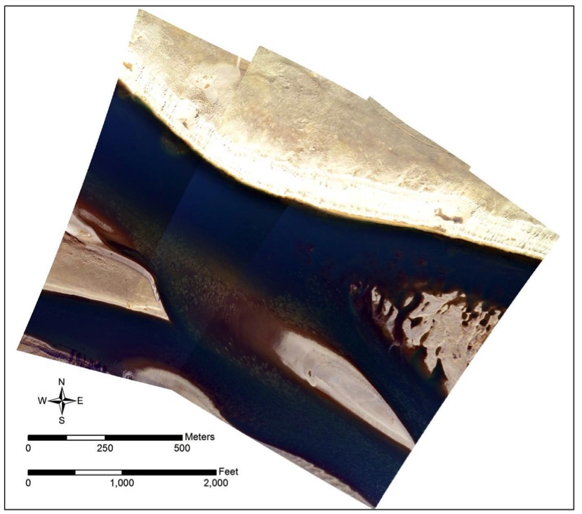
On February 27, 2014, a fracture was discovered in one of the spillways at Wanapum Dam on the Columbia River, Washington. To reduce pressure on the spillway, while the fracture was investigated and repaired, dam operators reduced the level of Wanapum Reservoir from a seasonal normal water level of ~570 ft to as low as 543 ft. This reduction exposed portions of the shoreline between Rock Island Dam and Wanapum Dam that had been inundated since the dam was constructed in 1963. As a result of the unanticipated drawdown, a number of relatively immobile benthic organisms such as freshwater mussels, snails, and clams may have been affected. Native and non-native species of fish such as Pacific lamprey also may have been affected along with invasive species of mussels, snails, and clams.
Estimating species composition and densities of stranded freshwater mollusks
In response, Grant County Public Utility District (Grant PUD) asked Environmental Assessment Services (EAS) in association with Blue Leaf Environmental to conduct land- and water-based surveys to characterize benthic communities potentially affected by the water-level reduction.
The purpose of this study was to estimate species composition and densities of stranded freshwater mollusks (mussels, clams, and snails) and provide a more general characterization of other stranded fauna, including fishes, crayfish, and amphibians. Specific objectives were to 1) characterize freshwater mollusk species composition and densities in dewatered areas; 2) assess freshwater mussel densities in areas unaffected by the water-level reduction; and 3) document fishes and other organisms present in the study area, and describe potential effects of water-level reductions on these organisms.
Using land- and water-based surveys to gain information to assist in mitigating and restoring protected species
Information gained from EAS’s land- and water-based surveys will assist Grand PUD and federal, state, and tribal governments make decisions on mitigating and restoring declining and protected species in the project area according to natural resource management plans.
U.S. Department of Energy, Pacific Northwest National Laboratory
Evaluating the Status and Condition of Canada Geese on the Hanford Reach
Assessing long-term trends in Canada geese reproductive success, migration patterns, and contaminant concentrations
Since the 1950s, researchers have monitored Canada geese on Columbia River islands to document the status and condition of the population and assess contaminant burdens from past Hanford Site operations.
EAS team members Brett Tiller and William Rickard have collected and analyzed data on the Hanford Reach goose population for decades. The biologists directed and participated in long-term monitoring studies to assess nesting success as well as banding studies to evaluate migration patterns of banded birds. They also conducted long-term surveillance of geese on 20 islands in the Reach to document levels of Hanford Site-related contaminants in the local Canada goose population.
Collecting and analyzing data on the Hanford Reach goose population
In 2010, EAS participated in a study to assess trends in reproductive success, migration patterns, and contaminant concentrations of Canada geese on the Hanford Reach over more than 50 years. The team summarized results of Department of Energy studies of Canada geese on the Hanford Reach since 1953.
The team concluded that, in general, the islands of the Hanford Reach provided good habitat for Canada geese nesting over five decades, evidenced by an average of nearly 200 nests per year and a hatching success rate of more than 70%. The proportion of the Canada goose population staying in the Columbia Basin changed over the 50 years of study, from about half of the geese staying all year in the 1950s to 73% staying local in the 1980s. Reasons for the shift are probably related to the increase in large-scale agriculture in the area, which provides a more stable food supply for the geese. Monitoring data describing contaminant concentrations of Canada geese for radionuclides did not indicate any significant exposures to contaminants that could compromise their health as individuals or a population.
Pacific Northwest National Laboratory publically released a report on the 2010 goose studies:
- Canada Geese at the Hanford Site–Trends in Reproductive Success, Migration Patterns, and Contaminant Concentrations, PNNL-19212
The report can be found at:
http://nerp.pnnl.gov/docs/ecology/reports/PNNL-19212_gooseRpt.pdf
U.S. Army Corps of Engineers, Portland and Walla Walla Districts
Identifying and Counting Migrating Fish
Identifying and counting adult fish to evaluate the status of threatened and endangered species
Managing fisheries in the Columbia River system requires ongoing data to assist resource managers evaluate the status of fish stocks, particularly threatened and endangered species. The EAS team works with Normandeau Associates and the U.S. Army Corps of Engineers to identify and count adult fish at mainstem dams with fish passage facilities on the Columbia and Snake rivers.
We collect data on adult salmon, steelhead, shad, lamprey, and other migrating and resident species as they pass through the dam’s counting stations. Our staff take fish counts by looking directly into fish ladders (4:00 a.m. to 8 p.m.). At night (8:00 p.m. to 4:00 a.m.) and during winter months, fish counters use video to record fish passage. EAS’s fish passage work assists federal, state, and tribal governments protect and restore targeted species.
U.S. Department of Energy, Mission Support Alliance
Documenting Rocky Mountain Elk Use Areas and Relative Abundance
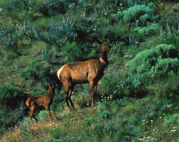
Monitoring Rocky Mountain elk to help document possible changes in elk use patterns
© Lawrence E. Bowman 2000, used with permission
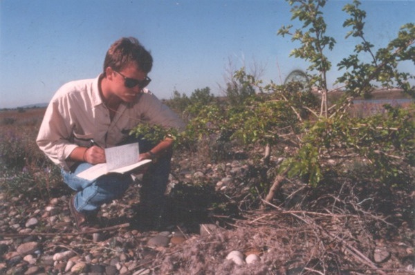
Archaeological evidence suggests elk have inhabited the shrub-steppe habitats of the Columbia Basin over the last 10,000 years, but the animals were hunted to extinction by 1850. Between 1913 and 1930 elk were reintroduced in the region. Scientists documented the first elk in the Mid-Columbia in 1972. This group, dubbed the Rattlesnake Hills elk herd, grew from about 30 animals in the 1970s to 800 or more in 2000.
EAS’s principal scientist, Brett Tiller, has studied and monitored this elk population since the 1990s. Historically the herd’s core range was limited to the Fitzner/Eberhardt Arid Lands Ecology Reserve, a protected portion of the Hanford Site/Hanford Reach National Monument, and private lands south and west of the reserve. Until 2010, only a few small herds of male (bull) elk were documented on central Hanford. But that year, field surveys detected that a herd of approximately 22 elk, cows, yearlings and a single adult bull, began occupying areas along the northern portion of central Hanford, in addition to the bachelor herds of bulls.
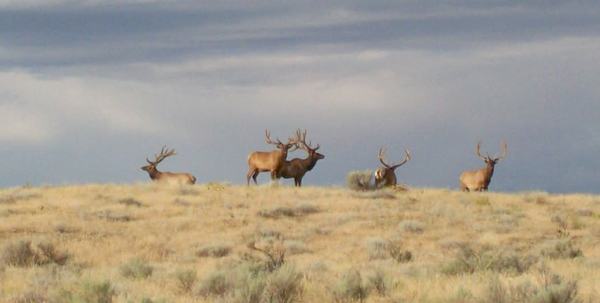
Conducting aerial surveys to document bull and cow herds
EAS works with the Department of Energy, U.S. Fish and Wildlife Service, and Washington State Department of Fish and Wildlife to monitor elk on central portions of the Hanford Site. In 2012, EAS staff successfully performed four aerial/ground survey events. The purpose of these surveys was to help document elk use areas, relative abundance, and possible changes in elk use patterns as a result of hunting on the ALE reserve. We found that elk numbers on central Hanford Site appeared to be increasing slowly, especially for antlerless elk. The maximum number observed in 2006 included 44 bulls and only 6 cows. The 2012 surveys documented that bull herds that still frequent area and herds of more than 30 cows are now regularly present.
In 2013, the Department of Energy’s Public Safety & Resource Protection Program publically released a report on elk monitoring for unlimited dissemination:
- Elk Monitoring Report for Calendar Year 2012, MSA, HNF-54666 Revision 0.
The report can be found at http://www.hanford.gov/page.cfm/EcologicalMonitoring
U.S. Department of Energy, Mission Support Alliance
Assessing Age, Sex Ratios, and Frequency of Testicular Atrophy in Mule Deer
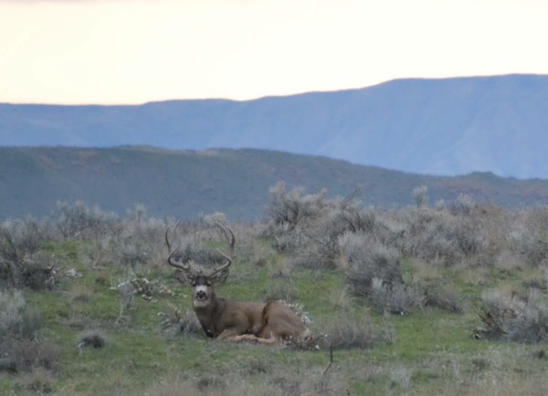
Performing roadside mule deer surveys to assess age, sex ratios, and abnormalities
Mule deer are an important part of the shrub-steppe ecosystem and valued for aesthetics and hunting. Their populations provide a rough indication of overall habitat quality. Additionally, they are a resource of interest and important to wildlife resource agencies and local tribes. Mule deer are common residents of the Hanford Site. Because the animals have been protected from hunting since the 1940s, the herds have developed unique population characteristics, including a large number of older males and males with abnormal antler growth. Misshapen, velvet-covered antlers are associated with testicular atrophy.
The EAS team has studied Hanford Site mule deer since 1991. In 2012, EAS staff conducted four roadside surveys on the site to assess age and sex ratios, and the frequency of testicular atrophy in males. During the study period, from December through January we observed a total of 288 mule deer. Bucks represented approximately 40 percent of the total number. Only one buck with abnormal antler growth was observed, which is similar to the 10-year average. We found the largest concentrations of mule deer in the vicinity of the Hanford townsite and between 100-F and 100-H Areas, including the White Bluffs townsite.
In 2013, the Department of Energy’s Public Safety & Resource Protection Program publically released a report on mule deer monitoring for unlimited dissemination:
- Mule Deer Monitoring Report For Fiscal Year 2013, MSA, HNF-55551 Revision 0.
The report can be found at http://www.hanford.gov/page.cfm/EcologicalMonitoring
U.S. Department of Energy, Mission Support Alliance
Preserving Avian Habitats and Populations – Sagebrush-Obligate Species
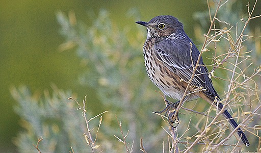
Evaluating populations of special status species and their habitat quality according with federal and state regulations
Photo credit: U.S. Fish and Wildlife Service
The Columbia Basin ecoregion provides a variety of habitats that support numerous special status avian species such as ferruginous hawks, American white pelicans, and bald eagles. The region, particularly the Department of Energy Hanford Site, also provides refuge to declining sagebrush habitat and shrub-dependent species, including sage sparrows, sage thrashers, and loggerhead shrikes. The Department of Energy monitors avifauna on the site to evaluate populations and habitat quality in accordance with federal and state regulations.
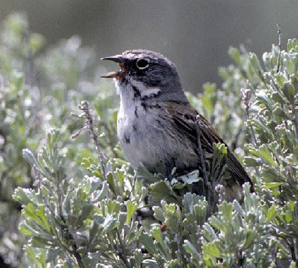
Monitoring declining sagebrush habitat and shrub-dependent species, including sage sparrows
Photo credit: Washington Department of Fish and Wildlife
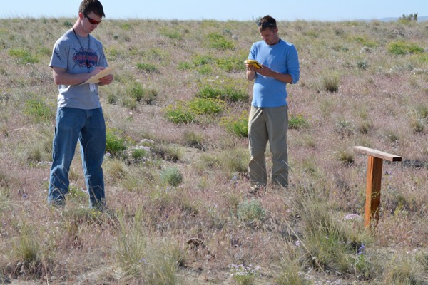
EAS team members have participated in roadside bird surveys to provide long-term monitoring data for more than two decades. In 2012, EAS staff again collected data to document species abundance and distribution and evaluate potential disturbance of valued habitats over large portions of the Hanford Site. We documented a total of 3,565 individual birds that represented 59 species in a variety of habitats. These surveys provide DOE a practical way to monitor changes in species richness and relative abundance of shrub-steppe birds over time and in response to various land-use changes.
In 2013 and 2014, the Department of Energy’s Public Safety & Resource Protection Program publically released reports on Hanford Roadside Surveys for unlimited dissemination:
- Hanford Site Roadside Bird Surveys Report For Calendar Year 2013, MSA, HNF-57027, Revision 0
- Hanford Site Roadside Bird Surveys Report For Calendar Year 2012, MSA, HNF-555491, Revision 0
The reports can be found at http://www.hanford.gov/page.cfm/EcologicalMonitoring
U.S. Department of Energy, Mission Support Alliance
Monitoring Washington State-Listed Frogs and Toads
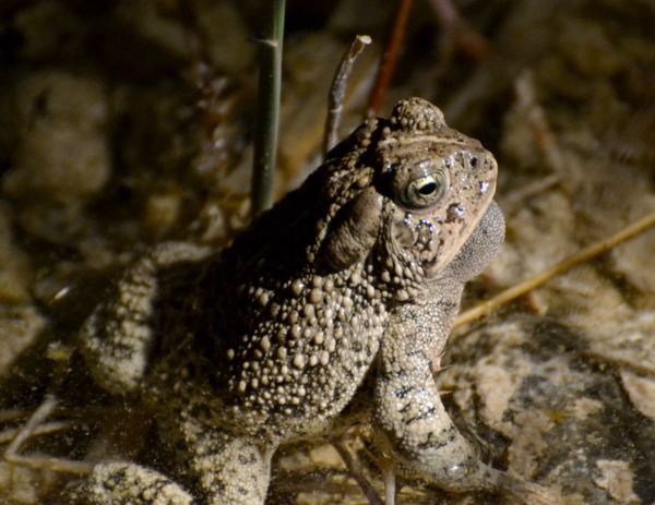
Conducting anuran surveys to document population status and protect sensitive breeding areas
Ephemeral streams and vernal pool areas provide breeding habitat for important species of frogs and toads along the Hanford Reach of the Columbia River, including Woodhouse’s toad, a Washington State monitor species. The state also has documented Great Basin spadefoot toad, a native species, and American bullfrog, an introduced species, in the area. The Department of Energy monitors these anurans on the Hanford Site because they are considered sentinel species and serve as fundamental indicators of ecological health.
EAS staff routinely conduct surveys for anurans to help protect sensitive breeding areas from project operations. In 2013, EAS surveyed known anuran breeding pools on the site to document population status and breeding success. We performed chorus counts to document species present and verify breeding was occurring at pools after they were isolated. This seasonal survey confirmed the continued presence of Woodhouse’s Toad, spadefoot toad, and American bullfrog on the site, consistent with previous monitoring efforts. A total of 96 anurans were documented. We determined that although breeding habits were influenced by river fluctuations, some successful reproduction appeared to be occurring.
In 2014, the Department of Energy’s Public Safety & Resource Protection Program publically released a report on anuran monitoring for unlimited dissemination:
- Hanford Site Anuran Monitoring Report for Calendar Year 2013, MSA, HNF-56676, Revision 0.
The report can be found at http://www.hanford.gov/page.cfm/EcologicalMonitoring
EAS supports and leads monitoring projects to characterize important biological resources and minimize impacts to them.
(click to enlarge images and view captions)